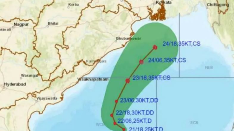
The depression over the Bay of Bengal is expected to worsen into a deep depression over the following 24 hours. According to the India Meteorological Department, it is expected to move northwestwards during the following 12 hours.
The storm is expected to recurve and proceed north-northeastwards during the next three days towards Bangladesh and the neighboring West Bengal beaches, according to the IMD’s latest bulletin.
The Depression over the west-central Bay of Bengal moved west-northwestwards at a speed of 06 kmph over the past 6 hours and was centered over the same region, about 600 kilometers south of Paradip (Odisha), 760 kilometers south of Digha (West Bengal), and 900 kilometers south-southwest of Khepupara (Bangladesh), according to the IMD bulletin.
Parts of coastal Odisha are likely to see light to moderate rain and thundershowers as a result of its effect. The meteorological service predicts that dry weather will prevail in the remaining areas.
Farmers are recommended to finish harvesting by October 23 due to significant rain.
During the period, sea conditions will be rough to extremely rough. Fishermen are urged not to enter into the west-central Bay of Bengal until October 25, and from October 24 to 26, along and off the Odisha coast and the north Bay of Bengal. Those who are in the deep sea should return to shore.
The Distant Cautionary Signal number-I (DC-I) has been raised at all Odisha ports.


 Finance


