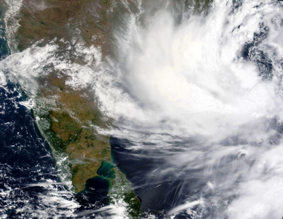
Cyclone Dana has intensified and is moving towards land from the sea, according to the India Meteorological Department (IMD), with the possibility of a small recurve after impact.
Cyclone Dana is expected to make landfall between Bhitarkanika and Dhamra in Odisha between Thursday night and Friday morning, but its path may change somewhat after landfall, according to Regional Meteorological Department Director Manorma Mohanty on Thursday.
Speaking to the media, she stated that the severe cyclonic storm ‘Dana’ is currently 210 km southeast of Paradip, 290 km south-southeast of Dhamra, and 350 km south-southeast of Sagar Island. It’s now traveling northwest. For the previous 6 hours, the storm has been heading north-northwest at 15 km/h.
She stated that while the storm’s path remains the same, Cyclone Dana may slightly recurve to the west-west-southwest.
The wind speed in Balasore, Bhadrak, and Kendrapara districts at the time of landfall is expected to be between 100 and 120 km/h. Along with this, high tides are predicted in the sea, and the storm is expected to pull down trees, power poles, and thatched houses. As a result, severe rainfall is expected in many areas over the next two days.
Heavy rain is expected in the districts of Mayurbhanj, Kendrapara, Balasore, Bhadrak, Jajpur, and Cuttack over the next 24 hours. A red alert has been issued for all of these districts. An orange alert was issued for Puri, Khurdha, Nayagarh, Dhenkanal, and Keonjhar districts. A yellow alert has been issued for Sundargarh, Deogarh, Angul, Boudh, Kandhamal, Ganjam, Jharsuguda and Sambalpur districts.
A red alert has been issued for Mayurbhanj, Keonjhar, and Bhadrak Balasore tomorrow, while an orange alert has been issued for Jagatsinghpur, Kendrapara, Cuttack, Jajpur, Dhenkanal, and Angul. A yellow alert has been issued for Puri, Khurdha, Deogarh, Sambalpur, Jharsuguda, Sundargarh, Nayagarh, and Boudh districts. A yellow alert has been issued for Malkangiri, Koraput, Kalahandi, Rayagada, and Nabarangpur districts on Saturday.


 Finance


