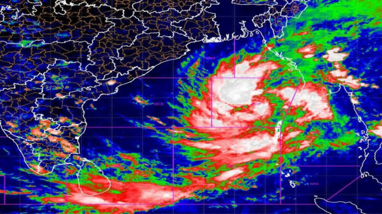
Cyclone Dana, which is currently developing in the Bay of Bengal, is predicted to make landfall between the Bhitarkanika and Dhamra regions on October 24 night and 25 morning, according to India Meteorological Department (IMD) scientist Umasankar Das.
Briefing media about the landfall, Das said, “The cyclone is most likely to hit Bhitarkanika and Dhamara from October 24 night to October 25 morning with a wind speed of 100-110 kmph gusting 120 kmph. Under its impact, north Odisha districts will witness enhanced rainfall intensity on October 24 and 25. The rainfall activities will decrease from October 26 onwards. Kendrapara, Bhadrak, and Balasore districts are likely to be affected badly due to the landfall.”
Das further said, “Given the adverse weather conditions, fishermen have been instructed to return to shore. Additionally, wind speeds will increase in coastal areas from today.”
According to the most recent IMD bulletin, the cyclonic storm over the east-central Bay of Bengal has moved northwestward at a speed of 15 kmph over the last 6 hours and is now centered at 8.30 a.m. in the same region, about 520 kilometers southeast of Paradip (Odisha), 600 kilometers south-southeast of Sagar Island (West Bengal), and 610 kilometers south-southeast of Khepupara ( Bangladesh). It is very likely to move northwestwards and intensify into a severe cyclonic storm over the northwest Bay of Bengal by the early morning of October 24, and cross the north Odisha and West Bengal coasts between Puri and Sagar Island near Bhitarkanika and Dhamra (Odisha) during the night of October 24 to October 25 as a severe cyclonic storm with a wind speed of 100-110 kmph gusting 120 kmph.


 Finance


