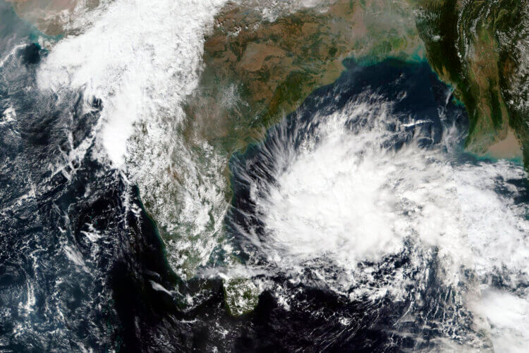
The severe cyclonic storm “Michaung” (pronounced as Migjaum) over west-central Bay of Bengal off south Andhra Pradesh and adjoining north Tamil Nadu coasts moved north-northwestwards at a speed of 9 kmph during the previous 6 hours and lay centered at 0430 hours IST on Tuesday over west-central Bay of Bengal off south Andhra Pradesh and adjoining north Tamil Nadu coasts, about 30 km northeast of Nellore, 130 km
Its intensity is currently at the center, with wind speeds of 90-100 kmph gusting to 110 kmph. It has moving north-northeastwards at a speed of 9 kilometers per hour over the last 6 hours.
Some of the wall cloud region is over land as the system approaches the shore to the north. The system is expected to move nearly northwards parallel and close to the south Andhra Pradesh coast and cross the south Andhra Pradesh coast between Nellore and Machilipatnam, close to Bapatla, as a severe cyclonic storm with a maximum sustained wind speed of 90-100 kmph gusting to 110 kmph on December 5 in the forenoon.
Meanwhile, rain has been falling in numerous parts of Odisha, including the capital city of Bhubaneswar, since Monday morning, significantly lowering the daytime temperature. The IMD has issued a heavy rain warning for six coastal districts of the state today.
Meanwhile, the Regional Meteorological Center in Bhubaneswar has issued a rain warning for five districts in south Odisha. An orange alert has been issued for the districts of Ganjam, Gajapati, Rayagada, Malkangiri, and Koraput, which may get 70 to 200 mm of rain at a pace of 40 to 50 kmph.
Given the scenario, Odraf teams have been sent out in these six districts. Additional fire departments have been dispatched. The Special Relief Commissioner (SRC) convened an emergency meeting with various departments and asked all district collectors to remain vigilant.


 Finance


