







 Finance
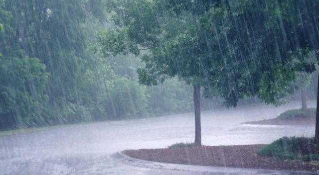
The India Meteorological Department has issued a red alert for six districts in Odisha for tomorrow, citing a low pressure system over the Northwest Bay of Bengal that is predicted to intensify and deliver exceptionally heavy rain to the state.
According to the IMD’s lunchtime report, the low pressure area over the Northwest Bay of Bengal and adjacent Gangetic West Bengal-North Odisha coasts was centered around 8.30 a.m.
The related cyclonic circulation reaches up to 9.4 km above mean sea level and is expected to meander over the same area, becoming more prominent over the next 2 to 3 days.
The monsoon trough at mean sea level is also passing through Jaisalmer, the center of the low pressure area in southwest Rajasthan, as well as Sheopur, Datia, Sidhi, Daltonganj, and the center of the low pressure area in the Northwest Bay of Bengal, before extending southeastwards to the Northeast Bay of Bengal up to 1.5 km above mean sea level. This is predicted to increase monsoon activity in Odisha.
The IMD has issued a red alert for Bhadrak, Jajpur, Kendrapara, Jagatsinghpur, Cuttack, and Kendujhar districts for July 26, indicating that heavy to very heavy rainfall, including exceptionally severe rainfall in one or two locations, is very likely.
An orange warning has been issued for Baleshwar, Sundaragada, Anugola, Dhenkanal, Mayurbhanj, Boudh, Puri, Khordha, Nayagada where heavy to very heavy rainfall is expected at isolated places. Besides, a yellow warning has been issued for Jharsuguda, Bargarh, Sambalpur, Deogarh, Subarnapur, Bolangir, Kalahandi, Kandhamal and Ganjam, where heavy rainfall is likely.
Thunderstorms accompanied with lightning and gusty surface winds with speeds reaching 30 to 40 kmph is also very likely at one or two places over Baleshwar, Bhadrak, Jajpur, Kendrapada, Jagatsinghapur, Kataka, Sundaragada, Jharsuguda, Baragada, Sambalpur, Debagada, Anugola, Dhenkanal, Kendujhar, Mayurbhanj, Subarnapur, Boudh, Balangir, Kalahandi, Kandhamala, Ganjam, Puri, Khordha, Nayagada.
The intensity is expected to remain high on July 27 as well. An orange warning has been issued for Jajpur, Kataka, Sundaragada, Jharsuguda, Baragada, Sambalpur, Debagada, Anugola, Dhenkanal, Mayurbhanj, where heavy to very heavy rainfall is likely at isolated places.
A yellow warning has been issued for Baleshwar, Bhadrak, Kendrapada, Jagatsinghapur, Subarnapur, Boudh, Nuapada, Kalahandi, Kandhamala, Puri, Khordha, Balangir and Nayagada for heavy rainfall.
Thunderstorm and lightning with gusty winds of 30 to 40 kmph is likely across most parts of the state.
On July 28, Sundargarh, Jharsuguda, Bargarh, Sambalpur, Kendujhar and Mayurbhanj will continue to be under an orange warning for heavy to very heavy rainfall. Additionally, a yellow warning for heavy rain has been issued for Balasore, Bhadrak, Jajpur, Kendrapara, Jagatsinghpur, Cuttack, Angul, Dhenkanal, Subarnapur, Boudh, Bolangir, Puri, Deogarh and Khordha. Thunderstorm activity with lightning and gusty winds is also forecast in several districts.
The weather is expected to gradually ease from July 29, but heavy rain will persist. Bargarh and Subarnapur are under an orange warning for heavy to very heavy rainfall, while Baleshwar, Bhadrak, Jajpur, Kataka, Sundaragada, Jharsuguda, Sambalpur, Debagada, Anugola, Dhenkanal, Kendujhar, Mayurbhanj, Boudh, Nuapada, Balangir, Nayagada are under a yellow warning.
Thunderstorms with lightning and winds of up to 40 kmph are also expected. Rainfall is expected to decrease further between July 30 and August 1, but scattered heavy showers will persist.
On July 30, a yellow alert was issued for Sundargarh, Jharsuguda, Bargarh, Sambalpur, Subarnapur, and Bolangir. On July 31 and August 1, Sundargada, Kendujhar, and Mayurbhanj are expected to receive heavy rains.
The IMD has encouraged inhabitants in the affected districts to stay careful, avoid waterlogged and low-lying areas, and follow local authorities’ directions.
Fishermen have been urged not to enter the sea during this time.