


 Finance
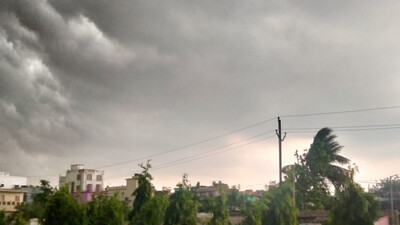
The India Meteorological Department (IMD) issued a series of yellow warnings for thunderstorms, gusty winds, and heat wave conditions in multiple districts of Odisha on Thursday, effective from April 17 to April 23, despite the fact that the state is currently not under any substantial synoptic systems.
While isolated areas of Angul, Nayagarh, Khurda, and Dhenkanal have received light to very low rainfall in the last 24 hours, the prognosis predicts a change toward more unpredictable weather conditions. Titilagarh experienced the highest maximum temperature of 42.0°C, while Jagatsinghpur had the lowest minimum temperature of 21.8°C.
The IMD has issued yellow warnings, outlining three key concerns in the next days:
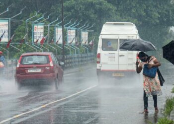
Beginning Day 1 (April 17), thunderstorms accompanied by lightning and gusty winds (30-50 kmph) are very likely in the afternoon or evening at isolated places. Intense squalls (40-50 kmph) are specifically warned for Mayurbhanj and Balasore on April 17. These conditions are expected to persist in several coastal and northern districts, including Keonjhar, Bhadrak, Cuttack, Puri, and Ganjam, through April 19.
From Day 3 (April 18-19), heat wave conditions are very likely to set in at isolated places over Bolangir, Jharsuguda, and Sambalpur. This heat wave is forecast to continue on Day 4 (April 19-20) over the same districts.
Sultry weather is expected to prevail at isolated places over coastal districts including Balasore, Bhadrak, Kendrapara, Cuttack, Jagatsinghpur, Puri, Khurda, Nayagarh, Ganjam, and Gajapati for five consecutive days from April 17 to April 21.
Rain or thunderstorm activity is expected to gradually decrease southward. After impacting northern and coastal areas till April 19, precipitation is expected to shift to southern districts like as Malkangiri, Koraput, and Rayagada between April 19 and April 23.
The IMD predicts a steady rise in maximum temperatures of 2-3°C during the next two days, followed by no significant change for two days and another rise of 2-3°C thereafter.
For Bhubaneswar, the prediction for the next 24 hours is partly cloudy skies with a chance of rain or thunderstorms, with maximum and lowest temperatures of 36°C and 28°C, respectively.
The bulletin advises farmers to avoid hot and humid circumstances in coastal zones over the next 24 hours.


